Format topics
and objects |
What do you want to do? |
The automatic formatting for
topics and objects on the map is determined by the map's theme.
It's a good idea to decide on an overall look for your map before
formatting topics individually. You can apply a suitable Map Theme
or modify the current theme to suit your needs.
After selecting a theme you can apply formatting to topics and
other objects on the map. The formatting you choose is applied
to the currently selected topics or objects.
To format topics and objects you can:
select it and then
use the buttons on the ribbon right-click a topic
to see the mini-toolbar with formatting commands
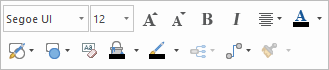
The
mini-toolbar for map topics: |
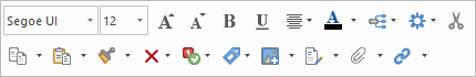
The
mini-toolbar for flowchart topics: |
|
|
select an object
(such as a relationship or boundary) and press ALT+ENTER,
or double-click to see the formatting options
When you set new formatting options in the format dialogs, you
can save the settings as the new default formatting for that object
type in the current map's theme.
To format your map quickly, you can select multiple topics when
you apply formatting. The Format Painter lets you transfer formatting
between topics, boundaries or relationships. If you find yourself
using a particular set of formatting attributes frequently, you
can create a topic style
with these attributes for easy re-use on other topics.
Some formatting options (font color, fill color) can be used
as map markers to classify topics on your map (for example a topic
in green text means "Michael's task") , but you can
also use these attributes casually to add visual interest and
clarity to your map. See Map markers
for more information on using these attributes as markers. |
See
also:
|
Set
the topic shape and color
You can set the topic shape and fill color for individual topics using
the commands on the Format tab,
in the Object Format group, or
on the mini-toolbar. More options (such as transparency and using a custom
shape) are available from the Object
Format dialog launcher.
You can only set these options when viewing the map.
Change topic shape and color
Select the topic(s).
To change the shape, do
one of the following:
| On the Format
tab, in the Object
Format group, click the Topic
Shape arrow. |
OR |
For a flowchart
topic: right click, then select Topic
Shape.
List of flowchart shapes |
Then click a topic shape,
or click Image
from Library ▼.
To change fill or line color,
do one of the following:
On the Format
tab, in the Object
Format group, click Fill
Color  or
Line Color or
Line Color  .. .. |
OR |
For a flowchart
topic: Right click, then select Fill
Color or Line
Color. |
On the Format
tab, in the Object Format
group, click Fill Color or Line Color
.
 Read Hint
Your choice of Line color effects
the topic's connecting lines and shape outline color. The Fill
color is used inside the topic shape or as a highlight
(for topics without shapes). You can set the fill transparency using the
Object Format dialog launcher.
Read Hints
More shape and color options
On the Format
tab, click the Object Format
dialog launcher.
On the Shape
and Color tab, choose the desired attributes for the topic.
Click the Map Theme button if
you wish to save these settings as theme defaults for this map, or
re-set the topic's formatting to the default from the theme.
Set the topic font
You can set the font face and font attributes for a single topic, and
the capitalization style for all topics. The Capitalization settings are
map theme settings, and so, they apply to existing topics and all new
topics you create. You can set these options when viewing the map or in
Outline View.
You can modify the placeholder text that
appears in central topics, main topics, floating topics, callout topics,
org-chart topics, and all levels of subtopics.
Change the topic font
Select the topic (s).
On the Format
tab, in the Font group
use the commands to change the topic font's attributes.
Read Hints
Change
topic text capitalization
Select a topic.
Selected topic |
Changes capitalization for |
Central Topic in a map |
Central topic only |
Main Topic in a map or Topic or Decision
in a flowchart |
All Main Topics only |
Callout Topic |
All callout topics only |
Floating Topic |
All floating topics |
Subtopic, subtopic of floating topic,
subtopic of callout |
All subtopics at this level and their
subtopics |
On the Format
tab, click the Font
dialog launcher.
On the Capitalization
tab, choose the capitalization style for topics.
Click the Map Theme button if
you wish to save these settings as theme defaults for this map, or
re-set the topic's formatting to the default from the theme.
Read Hint
Set default placeholder text
On the Design
tab, click Edit Default Text.
In the Edit Default Text dialog, enter new
placeholder text in the corresponding topic field.
Set topic size
There
are a number of options for controlling the size of topics. You can choose
to automatically resize topics based on their contents or set a specific
topic size for individual topics. You can give a map a cleaner look and
make it more presentable by increasing the size of smaller topics
to match the width of the largest topic within the same branch. It also
aligns the beginning of text in each level.
Size topics based on their contents
Select a topic or multiple topics, right-click
and choose Format Topic.
In the Format Topic dialog, click the
Size and Margins tab.
Enable the Automatic
Topic Size option.
Set the size of a specific topic
Select a topic or multiple topics, right-click
and choose Format Topic.
In the Format Topic dialog, click the
Size and Margins tab.
Enable the Fixed
Topic Size option and set the
topic size in the Height
and Width
boxes to create topics of a specific
size.
If the amount of content exceeds the size
of the topic, the content is truncated and a blue triangle appears
in the lower right corner of the topic. You can view the whole topic
by hovering over the icon.
Match topic widths
Do one
of the following:
| On
the Format tab, click the Match
Width arrow, and choose
Match Width for All Topics
|
Or |
Select
multiple topics, then on the Format
tab, click the Match
Width arrow, and choose
Match Width for Selected Topics. |
Or |
Select
a topic branch, then on the Format
tab, click the Match
Width arrow, and choose
Match Width for Selected Branch(es). |
To reset topics to their original width,
choose Reset Widths.
Set
default line thickness
You can set the default connector-line thickness
in central topics, main topics, floating topics, callout topics, org-chart
topics, and all levels of subtopics.
Right-click
the central topic, and choose Format
Topic.
In the Format Topic dialog, click the
General Layout tab.
Choose one of the following
options from the Line thickness applies
to drop-down list:
· All
Topics — applies to lines to all
topics
· Main Topic Lines
— applies to lines between the central
topic and main topics
· Organic Lines —
thickness settings for topic levels below the central topic are ignored
Set
default topic style
You
can set the default style for topics of the same type.
Select the topic containing
style to set as the default style.
On
the
Format tab,
click
Set Default Style.
To reset the topic style to the default
theme, select a topic and click Reset to Default
on the
Format
tab.
Number topics
The Topic Numbering command can be used in Map View or Outline View
to add a numbering scheme to the subtopics of the selected topic. If the
central topic is selected the numbering is applied to the whole map.
 Read Note
Select one or more topics
whose subtopics you want to number. (Numbering can only be applied
to topics with subtopics).
Do one
of the following on the Insert
tab, in the Topic Elements
group:
| Click the Numbering
arrow and choose the type of numbering to use. |
Or |
Click the Numbering
arrow, click Numbering Options,
choose the options
you want to use, then click OK. |
Or |
Click Numbering
to number the map with the current options. |
Numbering is added at the start of the topic text for all subtopics
up to the specified depth. If you add, remove, or reorganize topics your
map will be automatically renumbered. If you switch to Outline
View, the same numbering scheme will be used for your outline.
Read Note
Read Hint
You can change, expand or reduce the numbering scheme at any time by
repeating the initial numbering steps. If you add numbering for a topic
(or the entire map) that already contains numbered subtopics, the new
numbering scheme will override the old and the subtopics will be renumbered.
Remove numbering
Select the root topic for
the numbering.
If
you numbered the whole map or outline at once you should select the
central topic.
If
you numbered a portion of your map or outline, and you want to remove
this portion's numbers, you must select the root (source) topic of
the numbered section.
If
you numbered the whole map or outline first, and then re-numbered
several sections separately you can remove all the numbering by selecting
the Central Topic.
On the Insert
tab, in the Topic Elements
group, click the Numbering
arrow, then click Remove Numbering.
Notes
on exporting numbered maps ▼
Include hidden topics in numbering
By
default, hidden topics are excluded from topic numbering. However, you
can modify map settings to include topics hidden by filters.
Do one
of the following:
| On
the File tab,
click Info, and then click Map
Settings |
OR |
Right-click
the map’s workbook tab, and choose
Map Settings. |
Disable the Renumber
topics when there are topics are hidden by filters check
box
Topic
size and margins
You can set the topic size and margins for individual topics using the
Object Format dialog launcher.
You can only set these options in Map View.
Select the topic(s).
On
the Format tab,
click the Object
Format dialog launcher.
On the Size
and Margins tab, choose settings to apply to a standard topic
shape. If a Custom shape is used, you'll see a preview image where
you can set the text area. Padding
applies to topics with images. The measurement units used (in or mm)
are set using MindManager's General
options.
Read Hint
Click the Map theme button if
you wish to save these settings as theme defaults for this map, or
re-set the topic's formatting to the default from the theme.
Topic
text and image alignment
You can set the topic text and image alignment for individual or multiple
topics in a variety of ways. You can only set these options in Map View.
Change the alignment of topic text and images
Select the topic(s).
For text alignment, on the
Format tab, in the Font group, click the Alignment
 arrow and select how
you want the text aligned within the topic.
arrow and select how
you want the text aligned within the topic.
Read Hint
For image alignment, in
the Format tab, Object
Format group, click the Align
pull down, then select Align Image
to set the options.
Read Hint
You can click the
button here if you wish to save these settings as the formatting defaults
for this map, or re-set the topic's formatting to the default for the
theme.
Format
boundaries and relationships
When you select a boundary or a relationship, the formatting options
on the Design tab are enabled, and you can use these to change the object's
appearance. See Boundaries and Relationships
for information on further modifying these objects.
Additional options are available when you right-click on the object,
and then click Format Boundary or Format Relationship (or double-click,
or select the object and press ALT+ENTER).
Select the formatting options
you want to use.
To see how the boundary
or relationship will look, click Apply.
Click the Map Theme button if
you wish to save these settings as formatting defaults for this map,
or re-set the object's formatting to the default from the theme.
Use
the Format Painter
The Format Painter transfers
format settings from one object (the source object) to another (the target
object). Usually, you will paint the format to another object of the same
type (e.g. from one topic to another, or from one text selection to another),
but you can also paint the format to a different object type (e.g. from
a boundary to a topic). In the second case, only the types of formatting
supported in the target object will be applied.
Format a single object with the format painter
Select the object or text
whose format you want to duplicate (the source object).
On the Home
tab, in the Clipboard group,
click Format Painter  . You'll see the cursor change to a paint-brush
  .
.
Read Hint
Paint the format to the
target object(s):
Format multiple objects with the format painter
On the Home
tab, in the Clipboard group,
click Format Painter
, then press CTRL and click to paint the same format on several objects.
On the Home
tab, in the Clipboard group,
double- click Format Painter , then click to paint the same format on several
objects.
Stop the Format Painter
Read Hint
Remove formatting
You can remove the formatting that you have applied to any map object
and return it to the default formatting (determined by the map's theme).
Select the topic, object,
or the text within a note or topic.
Read Hint
On the Home
tab, click the Delete button,
and then select Formats .
Format the map
background
MindManager comes with a wide assortment of suitable background images
designed to enhance the look of your map. You can add these background
images from the MindManager Library
pane, or use your own image from a file. You can combine a background
image with a solid color by adjusting the image transparency.
Add a background from the Library
Right-click the map background,
click Background, and then
click Assign Image from Library
In the Library
pane, locate the image you want to use.
Click the preview image
in the lower part of the Library
pane to add the image to your map.
Add a background image from a file
You can use a background image from a file in one of the following formats:
bmp, emf, wmf, gif, jpeg/jpg, pcx, png
Do one
of the following:
| On the Design
tab, click Edit Background. |
Or |
Right-click the map background, click Background, and then click
Background Properties. |
Click Select
Image and navigate to the image file.
You can drag an image from
a file list (for example, from Windows Explorer) into the image preview
area in the dialog to add it as a map background.
Change background color, transparency and image tiling
Do one
of the following:
| On the Design
tab, click Edit Background. |
Or |
Right-click the map background, click Background, and then click
Background Properties. |
Select the background Color if desired.
Select a background image
file. (If you've already selected an image, you'll see its name here.)
You can use transparency to "fade" it so it doesn't detract
from the map.
The image will be tiled
according to the Tile options
you select.
Set the image transparency
(0% is opaque).
Read Hint
Remove the background
Do one of the following:
| On the Design
tab, click Edit Background. |
Or |
Right-click the map background, click Background, and then click
Background Properties. |
To remove the image, click
Remove Background Image.
To remove the color, set
the Color to None.